
Northumberland Day will be celebrated on Sunday 30th May 2021. In anticipation of the day, we present our Map of Northumberland and our portrait of the county.
Northumberland is a maritime county in the far north-east of England. The contrast between the south-east and the rest of the county is dramatic. The largest town of Northumberland is Newcastle upon Tyne, which stands on the north bank of the Tyne, and surrounding it is a small but dense conurbation stretching to both banks of the river and along the coast, but beyond these areas Northumberland is rural and sparsely populated.
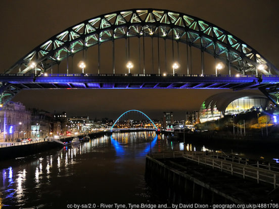
Newcastle is one of Great Britain’s major cities. Grand. Impressive. Distinctive. In large parts, Newcastle still retains a mediæval street layout. Narrow alleys or ‘chares’, most of which can only be traversed by foot, still exist in abundance. Stairs from the riverside to higher parts of the city centre and the extant Castle Keep, originally recorded in the 14th century, remain in places. The Tyne Gorge, between Newcastle on the north bank in Northumberland and Gateshead on the south bank in County Durham, is famous for a series of dramatic bridges, including the Tyne Bridge of 1928 which was built by Dorman Long, and Robert Stephenson’s High Level Bridge of 1849, the first road/rail bridge in the world.
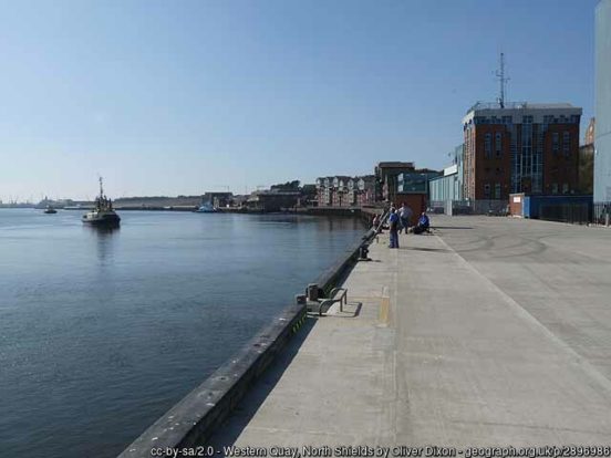
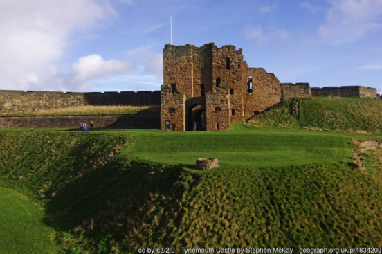
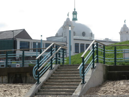
To the east of Newcastle is Wallsend, the site of the Roman fort of Segedunum, the fort protecting the eastern end of Hadrian’s Wall. North Shields lies further east, close to the mouth of the Tyne. The town’s name derives from the Middle English schele meaning “shieling” (temporary sheds or huts, used by fishermen in this case). The town is still known for fishing and the trades associated with seafaring. The coast begins at Tynemouth, a major port and a busy industrial gateway to the Newcastle conurbation. Tynemouth Castle stands on a rocky headland. The moated castle-towers, gatehouse and keep are combined with the ruins of the Benedictine priory where early kings of Northumbria were buried.
North of the Tyne up to the port-town of Blyth are a number of coastal towns, including the famous resort of Whitley Bay, but beyond that is undisturbed rural Northumberland seacoast. The coastline is generally low-lying and rocky, with numerous little bays and modest villages. The ruins of Dunstanburgh Castle, the largest in Northumberland, stand on a headland between the villages of Craster and Embleton. Warkworth Castle is a ruined mediæval building standing in a loop of the River Coquet, a mile from the coast.
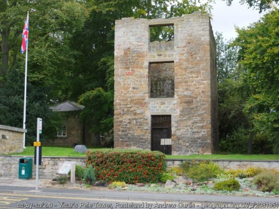
Inland from the coast and north of the conurbation along the Tyne are several small towns. Cramlington is a new town begun in the 1960s. Ponteland is notable for the old bridge from which it takes its name and a ruined pele tower. Bedlington was historically constituted a liberty of the Bishop of Durham. Morpeth grew at an important crossing point of the River Wansbeck. Ashington is a former coal mining town, the birthplace of footballer Jackie Milburn. The village of Belsay, five miles from Ponteland, is the location of both Belsay Castle (EH), a ruined 14th-century mediæval castle, and Belsay Hall (EH), the 19th-century grand mansion built to replace it.
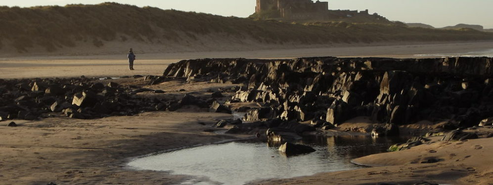
In the north are sites resonating with history: Bamburgh Castle sits perched on a precipitous rock which was the first seat of the Bernician kings. Opposite Bamburgh are the Farne Islands stretching into the North Sea and well known for their abundant birdlife, and north of them the largest and most famous is Lindisfarne or Holy Island, which was the first Christian missionary centre in Northumbria. Lindisfarne Priory (EH) was founded in 634 and dissolved at the Dissolution. Lindisfarne Castle (NT) is a 16th-century castle, much altered by Sir Edwin Lutyens in 1901 to serve as a magnificent stately home for Edward Hudson. Norham Castle (EH) overlooks the River Tweed, the border between Northumberland and Roxburghshire. The castle saw much action during the wars between the two kingdoms and in times of peace it was active in the struggle to keep down the border reivers.

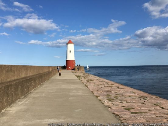
Alnwick is a small market town mainly known as the location of Alnwick Castle, seat of the Dukes of Northumberland. Edlingham Castle is a small castle ruin standing in a valley to the west of Alnwick. Berwick-upon-Tweed is a sturdy town on the north bank of the Tweed. It was once a wealthy port and the county town of Berwickshire and there is still debate about whether it belongs to Northumberland or to Berwickshire. The ruined Berwick Castle (EH) was founded in the 12th century by the Scottish King David I. The castle’s location in the hotly disputed border country between England and Scotland made it one of the most important strongholds in the British Isles, and it enjoyed an eventful history.
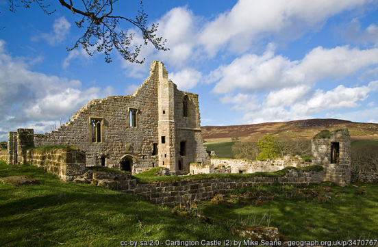
Inland, Northumberland is a county of fells and dales, part of the Pennine chain. The fells fill most of the county, bleak and beautiful and largely unpopulated. In the north of the county are the Cheviot Hills. The Cheviot (2,674 feet), close to the Roxburghshire border, is the county top. A great deal of this high moorland is protected in the Northumberland National Park. Castles and peel towers abound; reminders of more lawless times. Cartington Castle is a ruinous, partly restored mediæval castle in the village of Cartington, looking down on the River Coquet. Chillingham Castle, a mediæval castle in the village of Chillingham, was the seat of the Grey (Baron Grey of Werke) and Bennet (Earls of Tankerville) families from the 15th century until the 1980s. Elsdon Castle, near Rothbury, is the best preserved mediæval motte and bailey castle site in Northumberland. Etal Castle is a ruined mediæval fortification in the village of Etal, built around 1341 by Robert Manners.
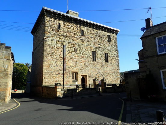
Hexham is an ancient market town in the south-west of the county, south of the River Tyne. The town is dominated by Hexham Abbey, whose stones incorporate an early Anglo-Saxon crypt from the monastery founded by Wilfrid in 674. Other highlights of the town are the Moot Hall, the covered market, and the Old Gaol. The nearby village of Corbridge is an ancient town, northernmost town of Roman ‘’Britannia’’ and the site of one of the earliest churches standing in Britain: the 7th-century St Andrew is one of the finest examples of early Anglo-Saxon architecture that has come down to us. Aydon Castle (EH) is a fortified manor house near the town.
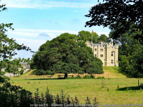
Haltwhistle lies to the west of Hexham , close to the Cumberland border. Nearby is Bellister Castle (NT), a castellated 19th-century mansion house attached to the ruinous remains of a 14th-century tower house.
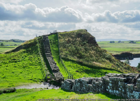
The Romans constructed Hadrian’s Wall from the River Tyne to the Solway Firth around AD 122. Hadrian’s Wall crosses the south of Northumberland east to west, from Wallsend-on-Tyne out to the Solway coast in Cumberland, a remnant but an impressive one of the great Roman wall with forts and mile-castles dotted along it.
After the Roman withdrawal, the Angles gradually gained control of the region. King Ida built the fortress at Bamburgh in 547 and founded the kingdom of Bernicia. Aethelfrith the Destroyer, his grandson, annexed the neighbouring kingdom of Deira in 605 and established the kingdom of Northumbria between the Firth of Forth and the River Humber. Lindisfarne was the centre for the spread of Christianity throughout this kingdom. The Danes conquered Northumberland in the 9th century, the land north of the River Tweed being lost to the Scots. Following the Conquest, the Normans built castles to defend against invasions from Scotland and Scandinavia. Northumberland’s history until the union of the crowns (1603) is a record of continuous border warfare. In medieval times, Northumberland prospered from the production and export of wool and hides. The coal trade expanded from the 13th century. Shipbuilding grew to become a major industry, as did glassmaking and chemical industries. During the late 20th century the heavy industries of the Tyne and Blyth valleys declined, and coal mining ceased.
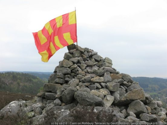
The Northumberland flag is a banner of the arms of the former Northumberland County Council. The shield of arms is in turn based on the arms mediæval heralds had attributed to the Kingdom of Bernicia. The Bernician arms were fictional but inspired by Bede’s brief description of a flag used on the tomb of St Oswald in the 7th century.
2 thoughts on “Northumberland Day – 30th May 2021”
My favourite English county. Great article Peter!
The parts of Northumberland
that ended up in the plastic
fake “Tyne & Wear”….. well
that’s done and dusted… such
is the spell of that T&W
abomination (which is always
and unwaveringly written with
zest and gusto and misguided
pride on all addresses both
private and business) that
it manages to get people north
of the Tyne to wilfully include
the ‘enemy’ River of Wear in
the tail end of their addresses,
and correspondingly those south
of the Tyne geographically around
the Wear to love writing the word Tyne… at
the start of their addresses! These lovely
North East folk have been chumped by the Whitehall
bureaucrats since 1974… taking T&W into their
hearts liver and lungs.. just like those
anti-Yorkshire Middlesbrough ‘Cleveland -Teessider’s’
and anti-Westmorland/Cumberland/Lancashire ‘Cumbrians’.
The Whitehall boffins must be laughing at victories
they could never have envisaged when
making up these (now obsessively much-loved)
Frankenstein creations masquerading as counties.