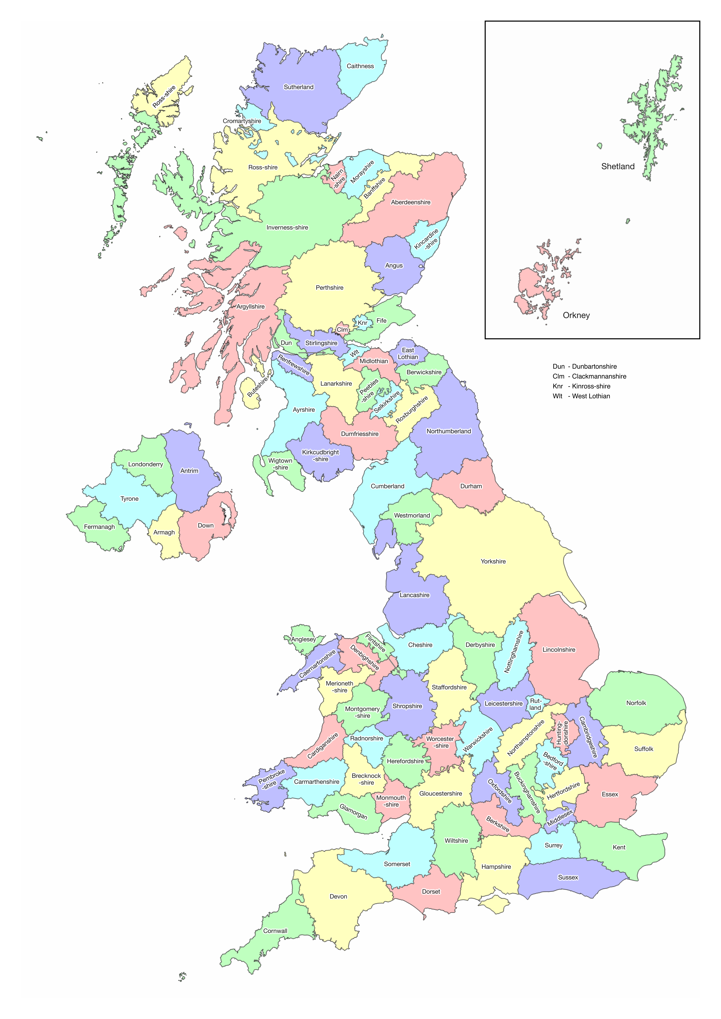
This is a large-scale map of the historic counties of the United Kingdom. It is based on Definition A of the Historic Counties Standard published by the Historic Counties Trust whereby detached parts of counties are associated with their host county. It uses county border data from the Historic County Borders Project. For printing purposes, please use the A3-sized map.
© 2025 Association of British Counties, licensed under CC BY 4.0![]()
![]() Free to share and adapt for any purpose – commercial or non-commercial – provided appropriate attribution to the Association of British Counties is made.
Free to share and adapt for any purpose – commercial or non-commercial – provided appropriate attribution to the Association of British Counties is made.