Useful Tools
- The Gazetteer of British Place Names provides an exhaustive Place Name Index to Great Britain, containing over 280,000 entries. It lists the historic county and the main administrative areas in which each place lies. The original and best.
- The Historic County Borders Project provides digitised border data for the historic counties of the UK in KMZ and SHP format. Freely available for public and commercial use. The project is closely based on the Historic Counties Standard, which provides a comprehensive definition of the names, areas and borders of the historic counties of the UK. These resources provide a basis which can be built-upon in your project with GIS solutions such as QGIS.
- The Historic Counties Postal Directory provides a directory ordered by post town, an indispensable tool to put the correct county in postal addresses. The ideal resource if you are looking to included historic county data in your address management system.
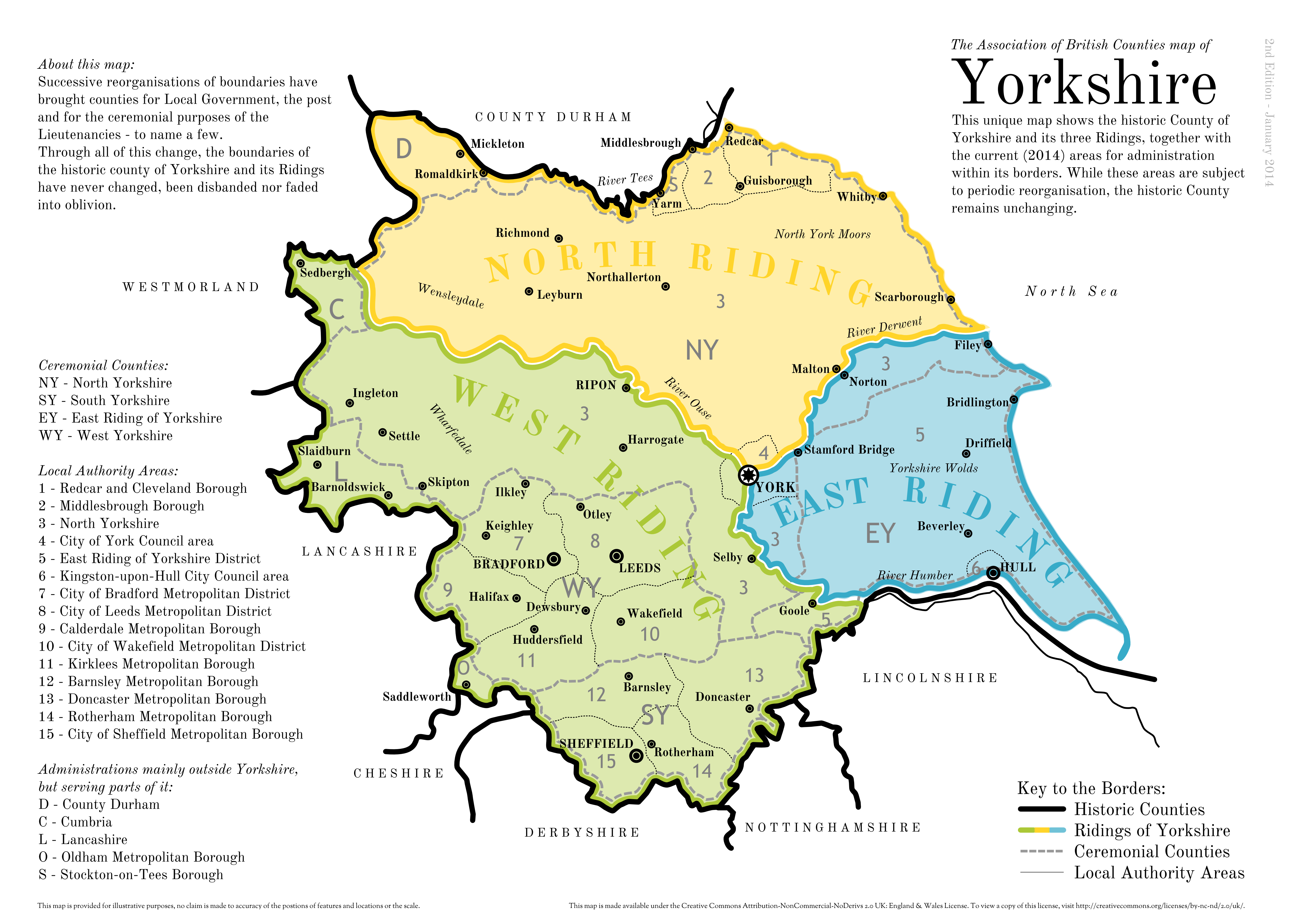
Downloadable Maps
These maps are © Association of British Counties / Michael Garber, licensed under CC BY 4.0![]()
![]() Free to share and adapt for any purpose – commercial or non-commercial – provided appropriate attribution to the Association of British Counties is made.
Free to share and adapt for any purpose – commercial or non-commercial – provided appropriate attribution to the Association of British Counties is made.


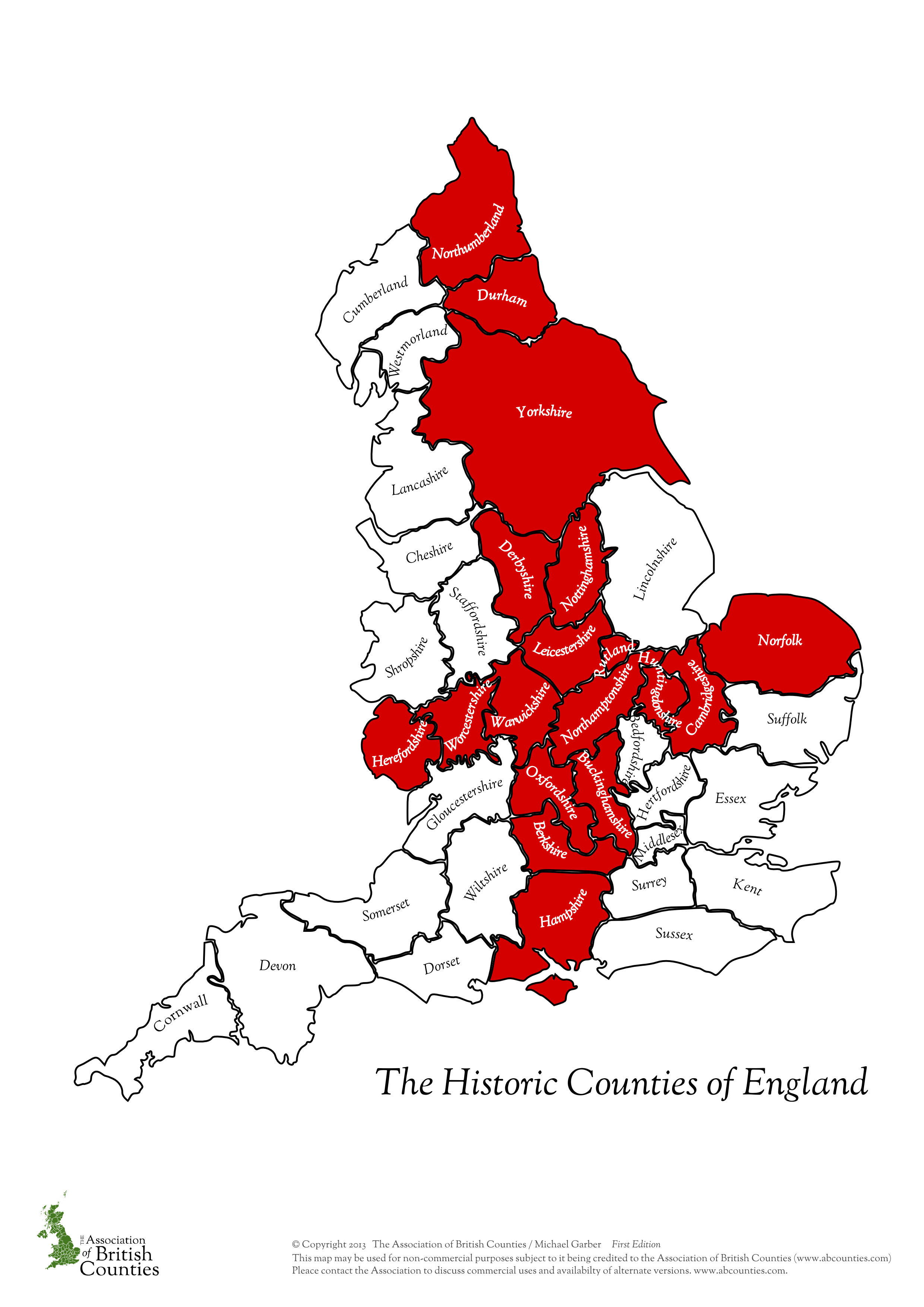
Individual counties