Dorset Day is celebrated on 1st June – the feast day of Saint Wite. In celebration we present a Map of Dorset and our portrait of the county.
Dorset is a maritime county on the south coast of England. Dorset contains an enormous variety of landscapes determined by the underlying geology. It has produced a county of grassy, sweeping hills and gentle valleys and coastal cliffs.
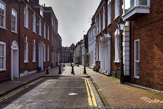
Poole, in the south-east of the county, is both a working port and a tourist resort. The historic port of Poole lies in what is now called the Old Town on the headland at the eastern entrance to Holes Bay. Since the 19th century a conurbation has developed around the town which now encompasses the former villages of Upton and Harmworthy west of Holes Bay; and Stanley Green, Waterloo and Longfleet east of the bay. The urban area spreads north to Canford Heath and Broadstone. To the east the conurbation includes Parkstone, Branksome, Talbot Village and has become contiguous with the urban area around Bournemouth in Hampshire.
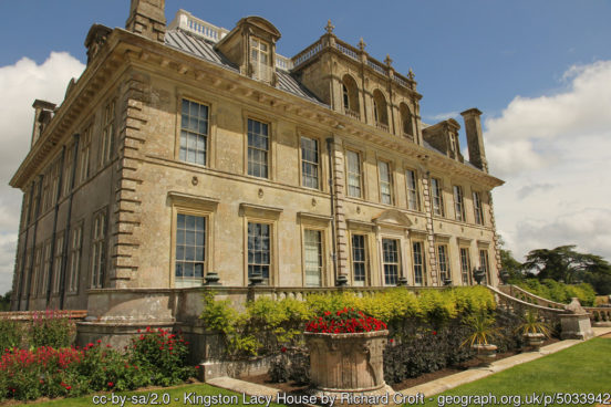
Several other towns lie just outside the Poole conurbation. To the north is Wimborne Minster with its Saxon church and many 15th, 16th and 17th century buildings. The nearby 17th century country house of Kingston Lacy (NT) is a majestic Italian Palazzo set in thousands of acres of gardens and pastures. North-east of Poole, along the Hampshire border, are the towns of Ferndown and Verwood.
Poole owes its position and prosperity to Poole Harbour, a vast and deep natural harbour. Brownsea Island (NT) is a nature reserve and the birthplace of the Scouting movement. The affluent Sandbanks peninsula lies at the eastern entry to the Harbour. From here to Hengistbury Head in Hampshire stretches Poole Bay. The Bay has steep sandstone cliffs and several ‘chines’ that allow easy access to its long sandy beach. The border with Hampshire lies between Branksome Chine and Alum Chine.

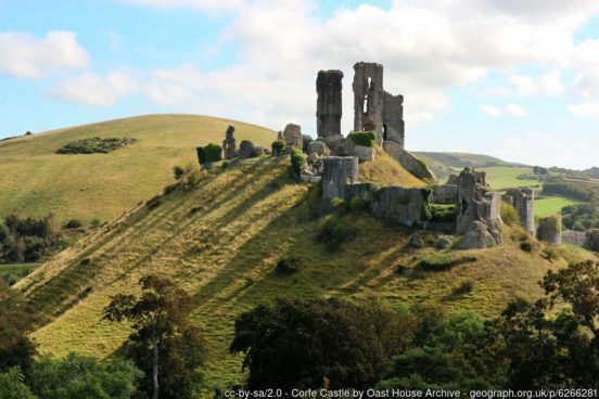
Wareham is an historic market town at the western end of Poole Harbour. West of Wareham is the isolated cottage of Clouds Hill (NT), home to T.E. Lawrence in the 1920s and 1930s. South of Poole Harbour is the broad peninsula known as the Isle of Purbeck. At its centre stands the noble ruin of Corfe Castle (NT). Built by the Conqueror, standing atop its hill, Corfe Castle is one of the classic images of a mediæval castle. Swanage was originally a small port and fishing village and later a wealthy seaside resort. Today tourism still flourishes.
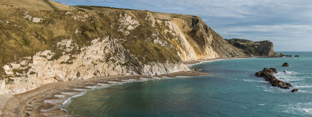
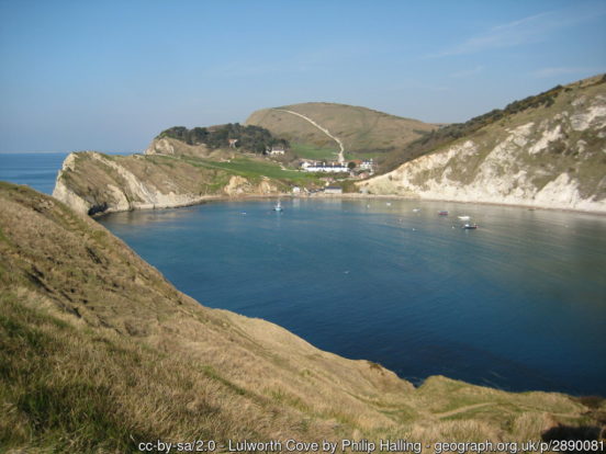
From Old Harry Rocks on the Isle of Purbeck, the entire Dorset coast is in the UNESCO World Heritage Site known as the “Jurassic Coast”, one of the greatest natural wonders of Britain. The Jurassic Coast consists of Triassic, Jurassic and Cretaceous cliffs, spanning the Mesozoic Era, documenting 180 million years of geological history. The name “Jurassic Coast” refers to the wealth of dinosaur fossils found here. It was here that Mary Anning found some of the earliest of the great dinosaurs and thus founded the science of palaeontology. The coast is also famous for its spectacular beauty. Lulworth Cove is a delightful curve bitten out of the cliffs. Lulworth Castle is an early 17th century hunting lodge. Close by is the famous Durdle Door.
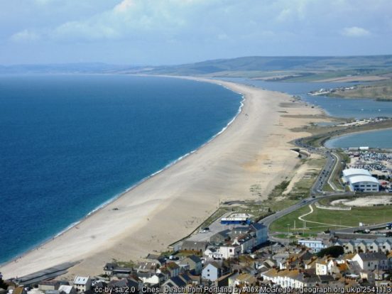
Half way along Dorset’s coast, on a sheltered bay at the mouth of the River Wey, is the resort town of Weymouth. To its south is the Isle of Portland. Portland Harbour, one of the largest man-made harbours in the world, was formed by the building of stone breakwaters between 1848 and 1905. Portland stone is a limestone famous for its use in British and world architecture including St Paul’s Cathedral. Portland is connected to the mainland by the mighty Chesil Beach, a shingle bank 18 miles long stretching out in a smooth line from Portland to Bridport’s harbour at West Bay. Behind the beach is the Fleet, a shallow tidal lagoon.
Since the Middle Ages Bridport has been associated with the production of rope and nets. Many buildings in Bridport date from the 18th century. To the west rises the Golden Cap (NT) (627 ft), the highest point on the south coast of England and visible for tens of miles along the coastline. The charming village of Charmouth lies to its west.
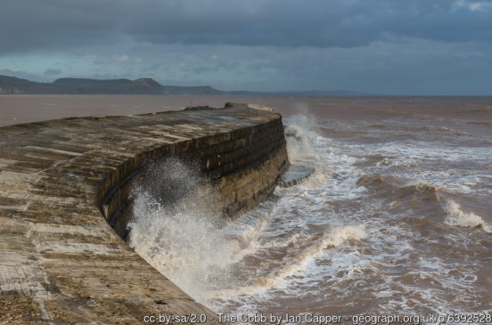
At the far west of the county is the pretty coastal town of Lyme Regis, “The Perl of Dorset”. One of the most famous sights of the town is the harbour wall, “The Cobb”, which features in Jane Austen’s novel Persuasion and in the book and film of The French Lieutenant’s Woman, whose author John Fowles lived in the town and wrote most of his major works here.
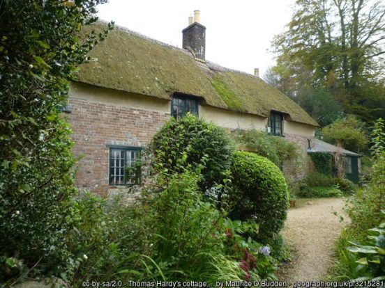
Dorchester, the county town, lies midway between its eastern and western extents and a few miles inland, separated from the coastal region by the South Dorset Ridgeway. It was the home of Thomas Hardy, whose famous Wessex novels were based in and around his familiar Dorset home, and in which Dorchester’s fictional counterpart is “Casterbridge”. Max Gate (NT) was designed by Hardy himself and his home from 1885 until his death in 1928. In the village of Higher Brockhampton, north-east of the town, is Thomas Hardy’s Cottage (NT) where he was born in 1840 and his home until he was aged 34. Wolfeton House is an early Tudor and Elizabethan manor house amongst the water-meadows north-west of Dorchester.
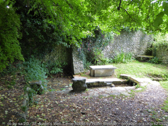
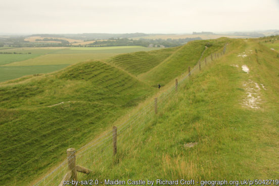
The Dorset Downs are an area of chalk downland in the centre of Dorset, north and west of Dorchester. On the Downs are two of Britain’s most famous historic monuments. Maiden Castle is the largest Ion Age hill fort in Britain. Its great banks and ditches scored deep into the hill are an impressive testament to their age and a source of wonder and inspiration to all who visit it. The Cerne Abbas Giant is a hill figure fully 180 feet high, depicting a standing nude male figure with a prominent membrum virile and wielding a large club in its right hand. It is often thought of as an ancient construction, though the earliest mention of it dates to the late 17th century. The village of Cerne Abbas contains the remains of Cerne Abbey, founded in 987. St Augustine’s Well is located in a peaceful area next to the burial ground of the Abbey.
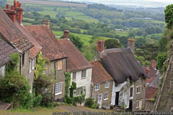
East of the Dorset Downs, separated from them by the River Stour, is the chalk plateau of Cranborne Chase. The Chase has many Neolithic and Bronze Age monuments, including the henge monuments at Knowlton and the remains of a number of Iron Age settlements on the downs, most notably the hill fort at Badbury Rings. The town of Shaftesbury lies at 705ft on the edge of the Chase. Here are the ruins of Shaftesbury Abbey, founded by King Alfred in 888. Adjacent to the abbey site is Gold Hill. The view from the top of the steep cobbled street has been called “one of the most romantic sights in England”.
To the north of the scarps of the Dorset Downs and Cranborne Chase is the Blackmore Vale. The east of the Vale is formed by the River Stour, the west by its tributary the River Lydden. The Stour enters Dorset at its most northerly point and flows down to Gillingham. There is a Stone Age barrow in the town, and evidence of Roman settlement: however the town was established by the Saxons. The church of St Mary the Virgin has a Saxon cross shaft dating from the 9th century. Constable’s painting of the old town bridge is in the Tate Gallery.
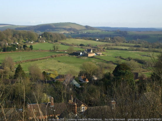
South of Gillingham, the Stour meanders across the Vale to Sturminster Newton. The town is at the centre of a large dairy agriculture region. The poet and polymath William Barnes was born in nearby Bagber. He wrote over 800 poems, some in Dorset dialect, amongst a wealth of other work. The Stour leaves the Blackmore Vale at Blandford Forum, a town sandwiched between the Dorset Downs and Cranborne Chase. The town is noted for its fine Georgian architecture, having been rebuilt in the style after a disastrous fire in the 18th century.
The market town of Sherborne stands on the River Yeo at the edge of the Blackmore Vale. Sherborne Abbey is of ancient foundation. In the Anglo-Saxon period it was the site of a monastic church which was a diocesan cathedral (705–1075). It was a Benedictine abbey church from 998 until the Dissolution since when it has been the town’s parish church. Sherborne Old Castle was built in the 12th century by Roger de Caen, Chancellor of England. The palace was destroyed in 1645 by General Fairfax. In 1594 Sir Walter Raleigh built an Elizabethan mansion in the grounds of the old palace, today known as Sherborne Castle.
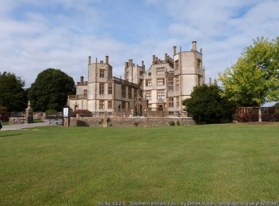
The town of Beaminster sits at the top of the valley of the River Birt, which flows south to Birdport and the sea. The towns was previously a centre of manufacture of linen and woollens.
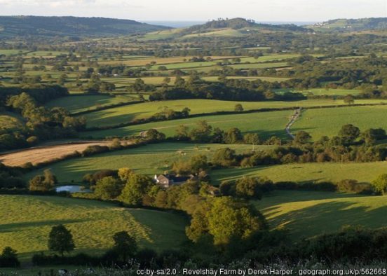
The Marshwood Vale is a low-lying, bowl-shaped valley in the west the county. It is drained by the River Char, which flows south-west to its mouth at Charmouth. The landscape of the Vale consists of narrow lanes winding between farms that lie amongst small fields, old hedgerows, copses and ancient semi-natural woods. The vale is almost wholly surrounded by hills, including Lewesdon Hill, Dorset’s county top. Atop of Pilsdon Pen and Lambert’s Castle Hill are Iron Age hill forts. The Vale has escaped large-scale agricultural intensification, leading to a landscape that still contains a wealth of wildlife.
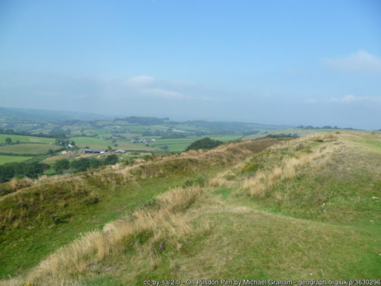
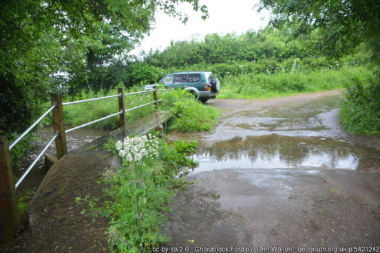
In the far west of the county the valley of the River Kit forms a salient of Dorset between Somerset and Devon. The Kit rises near Wambrook and flows down passed Chardstock, being crossed by the Fosse Way south of Tytherleigh before joining the Axe.
Dorset’s high chalk hills have provided a location for defensive settlements for millennia. There are Neolithic and Bronze Age burial mounds on almost every chalk hill in the county along with a number of Iron Age hill forts, including Maiden Castle – the most famous of them all. The Romans landed in Dorset at Poole Harbour and the Fleet and quickly conquered the area. Dorset has many notable Roman artefacts, particularly around the Roman town of Dorchester. From about AD 400 to 650, the future Dorset was an independent British kingdom. By the end of the 7th century, Dorset had become part of the Saxon kingdom of Wessex, with the first record of Dorset (‘Doseteschire’) being in 841. The Saxons established a diocese at Sherborne and Dorset was made a shire. The Domesday Book documents many villages corresponding to modern towns and villages and there have been few changes to the parishes since.
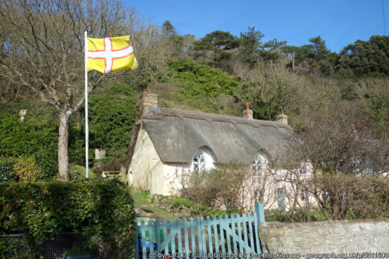
The flag of Dorset (also known as the Dorset Cross, and Saint Wite’s Cross) comprises a white cross with a red border on a gold background. The Dorset militia and regiment used the colours gold, red and green. The gold represents several things related to Dorset: Wessex, Dorset’s agriculture, Dorset’s sandy beaches, Golden Cap and Gold Hill. The flag also recognises St Wite, a female Dorset saint who is buried at Whitchurch Canonicorum.
