Devon Day is celebrated on 4th June, the feast day of Saint Petroc. In anticipation we present our Map of Devon and a portrait of the county.
Devon is a maritime county in the West Country of England.
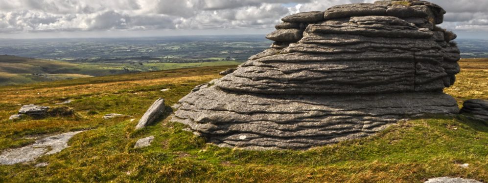
In the south west of Devon lies the vast moorland of Dartmoor. The moor covers over 300 square miles: a rough, infertile land, grazed by hardy beasts, but providing spectacular scenery. Dartmoor is, geologically, a vast lump of granite, which stone shapes and colours the landscape and the villages of the moor. The moor rises to its highest point at 2,037 feet on High Willhays, Devon’s county top. The whole moor is a great range of hills, many capped with dramatic exposed granite tops, known as tors. The high moors are overlaid with thick deposits of peat and blanket bogs surrounded by large expanses of upland heathland and grass moorland. Around the high moor are the gentler, green valleys and enclosed fields of the Dartmoor farms.
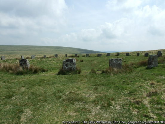
The moor is covered with the remnants of ancient civilisations with around 5,000 hut circles, the remnants of Bronze Age houses, surviving. Grimspound, famously featured in The Hound of the Baskervilles, consists of a set of 24 hut circles surrounded by a low stone wall. Across the moor are also numerous kistvaens (Neolithic stone box-like tombs), stone circles, standing stones and stone rows. Shovel Down has the remains of several stone rows, the Fourfold Stone Circle, and several standing stones. Grey Wethers is a pair of prehistoric stone circles, each 100 feet across and 15 feet apart. At Merrivale is a Bronze Age settlement, two stone rows, solitary standing stones, burial cairns, and a stone circle.
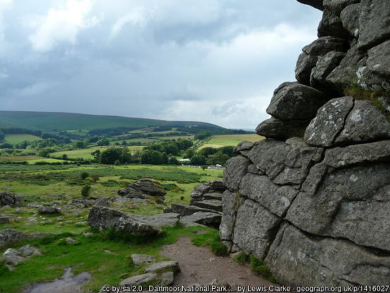
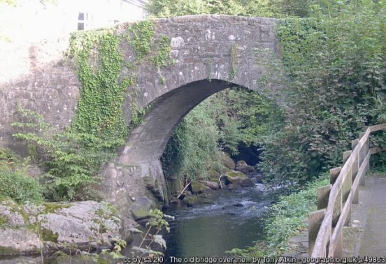
Princetown is the highest town on the moor and the site of Dartmoor Prison. Ivybridge, at the south of the moors, has a rich heritage of traditional Devon industries such as milling and cloth making. The town’s name comes from the 13th century hump-backed bridge over the fast flowing River Erme. Bovey Tracey, on the eastern edge of the moor, promotes itself as “The Gateway to the Moor”. Castle Drogo (NT) stands high above the ancient woodlands of the Teign Gorge. Inspired by the rugged Dartmoor tors that surround it, the castle was designed and built by renowned 20th-century architect Sir Edwin Lutyens.
The South Devon plateau wraps around the southern and western edge of Dartmoor. Dartmoor provides a visual backdrop to most areas of the plateau, as well as being the source of eleven of the rivers that flow through and dissect the plateau, giving the area its distinctive landform. At its core, South Devon is a fertile, agricultural landscape, with smooth, rounded hills separated by deep, wooded valleys; a patchwork landscape of arable and improved pasture. The resultant mosaic of habitats supports many arable and grassland plants and farmland birds. Much of the character is derived from buildings constructed from local stone or cob, with thatched or local slate roofs.
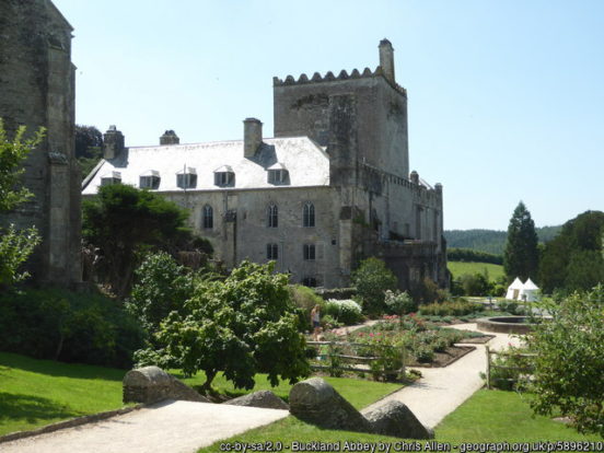
The border with Cornwall is marked by the River Tamar almost from coast to coast. Between the Tamar and the heights of the moor lies the stannary town of Tavistock. Its history dates back to at least 961 when Tavistock Abbey, whose ruins lie in the centre of the town, was founded. Its most famous son is Sir Francis Drake. To the south is Buckland Abbey (NT), originally a Cistercian abbey founded in 1278 by Amicia, Countess of Devon. After the dissolution it became a great house, home to Sir Richard Grenville and, later, Sir Francis Drake.
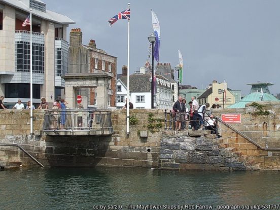
Plymouth stands between the mouths of the rivers Plym to the east and Tamar to the west, where they join Plymouth Sound. It has been the site of a major naval port, Devonport, since the days of Queen Elizabeth I. The old part of Plymouth is known as The Barbican, between the Plym and Plymouth Hoe, built around Sutton Harbour. Plymouth Hoe is a large flat-topped hill dominated by The Citadel, a fortress which still serves as a military establishment. The Mayflower Steps in Sutton Pool commemorate the spot whence the Pilgrim Fathers left for the New World in 1620. The towns of Plympton and Plymstock lie east of Plymouth, maintaining their own identities though also forming residential suburbs. Nikolaus Pevsner described the Georgian Saltram House (NT) at Plymton as “the most impressive country house in Devon”.
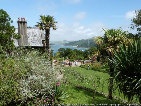
To the east of Plymouth are the quiet, unspoilt landscapes of the South Hams. The coast is very lovely, rugged between Thurlestone and Salcombe, from where a network of craggy tidal creeks, the Kingsbridge estuary, reaches deep inland to Kingsbridge. The Estuary is described by geologists as a “ria”, a flooded valley. Salcombe and Kingsbridge are both tourist destinations, popular with sailing enthusiasts. Overbecks (NT) is an Edwardian country house tucked away on the cliffs above Salcombe. The garden is filled with exotic and rare plants.
Dartmouth is a busy port and naval town on the south bank of the estuary of the River Dart. The town contains many mediæval and Elizabethan streetscapes and is a patchwork of narrow lanes and stone stairways. One of the best known buildings is the 17th-century Butterwalk.
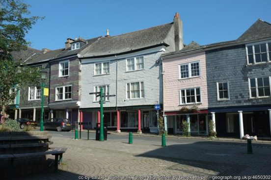
Totnes is a pretty market town tumbling down the hill to the head of the estuary of the River Dart. Totnes’ history dates back to 907 when its first castle was built. The Butterwalk is a Tudor covered walkway that was built to protect the dairy products once sold here from the sun and rain. Totnes Elizabethan House Museum is in one of the many authentic Elizabethan merchant’s houses in the town, built around 1575. Totnes is a thriving centre for music, art, theatre and natural health. It has a sizeable alternative and “New Age” community.
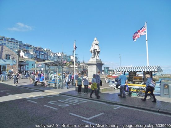
Tor Bay faces east into the Channel and forms a natural harbour, bounded by headlands: Hopes Nose at the north and Berry Head in the south. At the south end is Brixham, a small fishing town famous as the spot at which William of Orange landed on 5 November 1688 to begin the Glorious Revolution. South of the village is Coleton Fishacre (NT), an early 20th-century country house in the Arts and Crafts style, built for Rupert D’Oyly Carte.
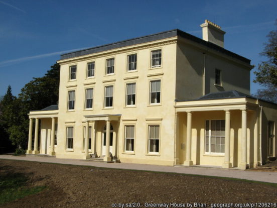
Paignton is a resort occupying the central part of Tor Bay. Paignton Beach and the Preston Sands are used for water sports including kite surfing and dinghy sailing. Paignton Zoo, opened in 1923, was one of the earliest combined zoological and botanical gardens in Britain. Torquay was initially a fishing village which grew, in the 19th century, to be the fashionable seaside resort it remains. The Kents Cavern cave system is Britain’s most important Stone Age site, home to early man for some 40,000 years. Agatha Christie was born and brought up in the Torquay. In 1938, she and her husband moved to Greenway (NT), a Georgian house and estate on the River Dart, where they lived for the rest of the their lives. The estate is served by a steam railway service from Paignton and Kingswear.
To the north and east of Tor Bay stretch the Devon Redlands, an informal name given to the rich, agricultural lands of the east of the county, especially around the valley and estuary of the River Exe. The Devon Redlands have a very strong, unified character, readily visible in the colouration of its ploughed fields, cliffs and outcrops, as well as the building material of its traditional stone and cob farmsteads, hamlets and villages. This colouration is derived from the red sandstone that underlies the area and produces the rich red soils that make the Redlands the agricultural heart of Devon. It is a region of gently rolling hills, with sunken lanes and high hedgerows enclosing smallish fields utilised both for grazing and crops.
Teignmouth lies on the north bank of the broad estuary of the River Teign. The town grew from a fishing port to a seaside resort of in Georgian times, with further expansion after the opening of the South Devon Railway in 1846. Today, its port still operates and the town remains a popular seaside holiday location. A few miles upstream is Newton Abbot, which grew rapidly in the Victorian era as the home of the South Devon Railway locomotive works. Bradley Manor (NT) is a 15th-century manor house in its own secluded woodland setting, with a notable great hall emblazoned with the royal arms of Elizabeth I.
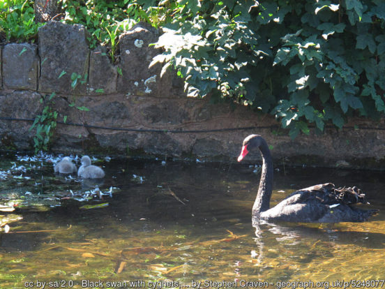
Dawlish grew in the 18th century from a small fishing port into a well-known seaside resort. Dawlish is known for its black swans (Cygnus Atratus), introduced from Western Australia. The railway line between Newton Abbot and the Exe Estuary is one of the most scenic in the country. The line runs along the river estuaries and right along the coast between them. The red sandstone cliffs and sea views are very dramatic. Powderham Castle is a fortified manor house standing on the west bank of the Exe estuary
The River Exe is the heart of the Devon Redlands. The river rises at Exe Head on Exmoor in Somerset and flows more or less south entering Devon at Exebridge. In Devon the Exe forges a broad, green valley. The first sizeable town is Tiverton, once a prosperous centre of the wool trade. Knightshayes Court (NT), north of Tiverton, was designed by William Burges for the Heathcoat-Amory family. An Iron Age hill fort, Cranmore Castle, stands atop Exeter Hill above the town, and a Roman camp was discovered on the hillside below Knightshayes Court near Bolham.

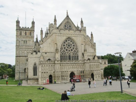
Further south the Exe comes to the city of Exeter, once a great port on the river. Exeter is the county town of Devon and the site of Exeter Cathedral, founded in the 12th century and the seat of the Diocese of Exeter. It is a city full of history and, despite suffering in the Blitz and the later redevelopment, it retains a wealth of historic buildings from many of its ages. Killerton (NT), just north of Exeter, is an 18th-century house with superb landscape gardens. Within the estate is the Iron Age hill fort of Dolbury. The Exe reaches the sea at a substantial ria, the Exe Estuary. The resort of Exmouth stands at the east side of the estuary mouth and Dawlish Warren stands at the west.
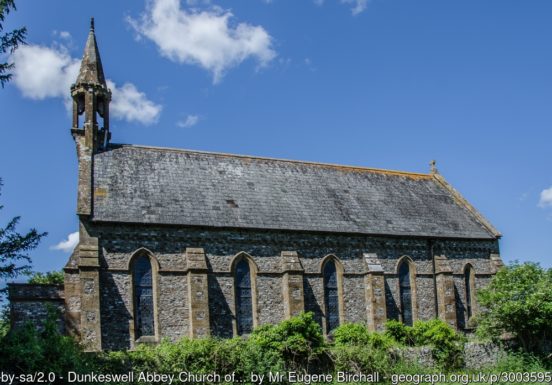
The most eastern part Devon, east of the Exe Valley, is informally known as the Blackdowns, after the Blackdown Hills which lie along the the border of Devon and Somerset, and in which rise the rivers which run north to south through the area. Traces of ancient and modern occupation on the Blackdown Hills include the remains of Iron Age hill forts, Norman motte-and-bailey castles and Second World War airfields. There are also beautiful buildings such as Dunkeswell Abbey and village churches. The hills in the southern part of the area, near Honiton, are more gentle.
The River Otter rises in Dorset and then flows south to Honiton, famous for its lace-making and an important stopping point along the Fosse Way. Bronze Age barrows (burial mounds) are commonplace in the hills south of Honiton and near the village of Dalwood. East of Honiton is the Loughwood Meeting House, an excellent example of a mid 17th-century English Baptist chapel with an unaltered interior.
Downstream is Ottery St Mary, the birthplace of the Romantic poet Samuel Taylor Coleridge. It is also famous for its Guy Fawkes celebrations involving flaming tar-soaked barrels being paraded through the town. Budleigh Salterton lies at the mouth of the River Otter and was the boyhood home of Sir Walter Rayleigh.

Sidmouth lies at the mouth of the short River Sid. Sidmouth remained a village until the vogue for coastal resorts grew in the Georgian and Victorian periods. The numerous fine Georgian and Regency villas and mansions are now mostly hotels.
The River Axe enters Dorset near Axminster. Axminster’s history is very much linked to the carpet industry, started by Thomas Whitty at Court House near the church in 1755. The original factory building is now a heritage centre. Carpet making continues in the town. The Axe flows to the English Channel at Seaton. Nearby Beer is home to a cave complex, the Beer Quarry Caves, resulting from the quarrying of Beer stone. This stone has been prized since Roman times, because of its workability for carving and for its gentle yellow colour on exposure to air. It was used for the finer carvings and pillars in many of Devon’s mediæval, Tudor, and Jacobean buildings.
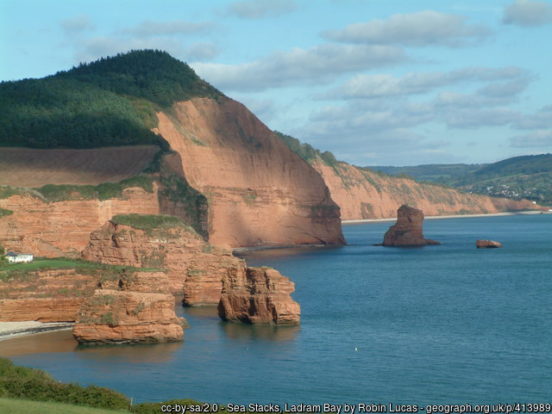
The coast from Orcombe Point near Exmouth east into Dorset forms part of the UNESCO World Heritage site known as the “Jurasic Coast” in reference to the wealth of dinosaur fossils found here from many ages. Full of beautiful scenery and fascinating geology, the coast is one of the greatest natural wonders of Britain.
The rolling ridges and plateaux of The Culm stretch across the north of Devon from Dartmoor in the south and Exmoor and the Devon Redlands in the east. The dominant influence on the landscape is the heavy clay overlaying the Upper Carboniferous Culm Measures, giving rise to heavy, wet soils, making cultivation difficult. Reflecting this, and the oceanic climate, the predominant land use is grass production for livestock. North Devon ‘Red Ruby’ cattle are common, their colour contrasting with the muted green and buff of the grasslands. The open, often treeless, ridges are separated by an intricate pattern of small valleys. This is largely a remote and sparsely populated landscape.
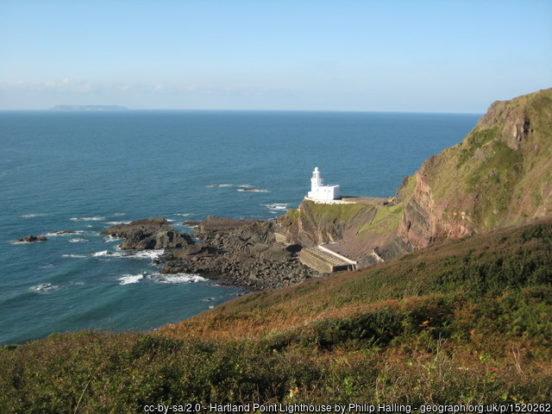
Hartland Point is the north-western tip of Devon. The Hartland Point Lighthouse was built in 1874. To its south, the wild and spectacular coastline stretches down to the border with Cornwall. The island of Lundy lies 12 miles off Hartland Point. Lundy has had a long and turbulent history but is now managed by the Landmark Trust for the benefit of its unique flora and fauna.
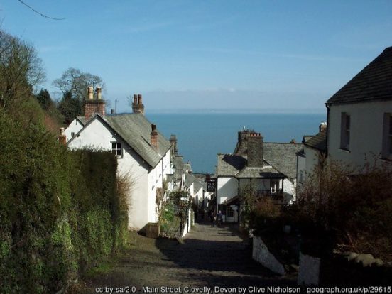
The Devon coast to the east of Hartland Point contains many jewels but many would argue that the village of Clovelly is the brightest of them all. It is a cluster of largely wattle and daub cottages on the sides of a rocky cleft. Its steep, cobbled main street descends 400 feet to the pier and harbour. The village’s famous donkeys these days lead a more leisurely life than their ancesters did. J M W Turner’s painting of Clovelly harbour hangs in the National Gallery of Ireland in Dublin. Northwest of the village is the Iron Age hill fort at Windbury Hill.
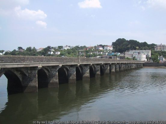
Cutting through the north Devon landscape are the valleys of the Taw, Torridge and their tributaries: made famous as the country of the two rivers in Henry Williamson’s Tarka the Otter. Between Appledore and Instow the estuary of the Torridge joins the estuary of the Taw as its enters Bideford Bay. The largest town in north Devon is Barnstaple, standing at the head of Taw estuary and a former port. The town centre still preserves a mediæval character. From the 14th century, it was licensed to export wool. Great wealth ensued. Its Victorian market survives, with a high glass and timber roof on iron columns. The historic port town of Bideford stands at the head of Torridge estuary. It is a harbour from which fishermen have sailed out into the Bristol Channel from time immemorial, and also one from which explorers and adventurers have set forth. The River Torridge is spanned at Bideford by the 15th-century Long Bridge. It has 24 arches all of different sizes.
The village of Braunton lies north of the Taw estuary. The undulating Braunton Burrows is the largest sand dune system in Britain. The Burrows end at Saunton Sands, a popular beaches for surfers, as are Croyde Bay and Woolacombe Sands to its north.
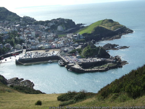
Ilfracombe is a popular seaside resort delightfully placed on a rounded promontory extending into the Bristol Channel, with a small harbour, surrounded by cliffs. The landmark of Hillsborough Hill dominates the harbour and is the site of an Iron Age fortified settlement.
The north of the county has few towns inland. Okehampton acts as a gateway to Dartmoor. Okehampton Castle stands a noble ruin on a high motte on the edge of the town. Holsworthy has occupied its hill top site since Saxon times. Great Torrington sits on a hill running down to the banks of the River Torridge. Castle Hill is the site of Norman and mediæval castles but was probably an Iron Age hill fort before these. Rosemoor Garden is nearby, a public display garden, owned and managed by the Royal Horticultural Society.
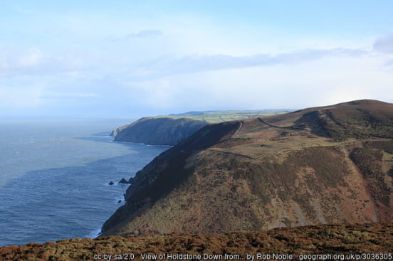
Exmoor is an area of hilly open moorland which stretches from its heartlands in Somerset into the far north-east of Devon. Exmoor was once a royal hunting forest from the Middle Ages. Devon’s Exmoor coast has the highest cliffs in southern Britain, culminating in the Great Hangman, a 1,043-foot “hog’s-back” hill with an 820-foot cliff-face. Its sister cliff is the 716-foot Little Hangman, which marks the western edge of coastal Exmoor.
The village of Lynmouth stands at the foot of the cliffs on which stand the town of Lynton. The two are joined by the Lynton Gorge and, since 1890, by the Lynton and Lynmouth Cliff Railway. Lynmouth was described by Thomas Gainsborough as “the most delightful place for a landscape painter this country can boast”. There is a memorial hall and garden in memory of the disastrous flood of 1952 in which 34 people died. On the edge of Exmoor is Arlington Court (NT) a neoclassical style country house built 1820-23. The property has a collection of over 50 horse-drawn carriages.
After the end of Roman rule in Britain, the kingdom of Dumnonia emerged covering Devon, Cornwall and Somerset, based on the former Roman civitas and named after the pre-Roman kingdom of Dumnonii. The Anglo-Saxons began to settle in Devon from the 7th century. In 710 King Ing of Wessex defeated the last recorded independent king in Devon. The term ‘Defenascir’ may have originated at this time.
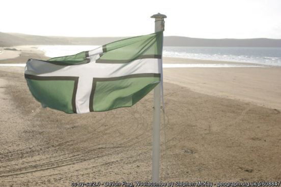
The Devon flag comprises a white cross with black edges on a green background. The green represents the colour of the rolling and lush Devon hills, the black represents the high and windswept moors and the white represents both the salt spray of Devon’s two coastlines and the China Clay industry. The flag is dedicated to Saint Petroc, a local saint with numerous dedications throughout Devon. June 4th, the feast day of Saint Petroc, is celebrated as Devon Day.
